


Click on any image to see it on a screen where you may be able to download it. You also can use Print Friendly, which will allow you to save the page as a pdf file. To do that, click the printer icon ![]() in the vertical Social Media bar on the far left edge of this page.
in the vertical Social Media bar on the far left edge of this page.
All Map Pages:
• Maps “home page” includes map of The Middle East
• Ottoman Empire through 1949
• 1967 to the present
• Jerusalem
• Bethlehem (coming soon)
• Area C/ Jordan Valley (coming soon)
• Loss of Land
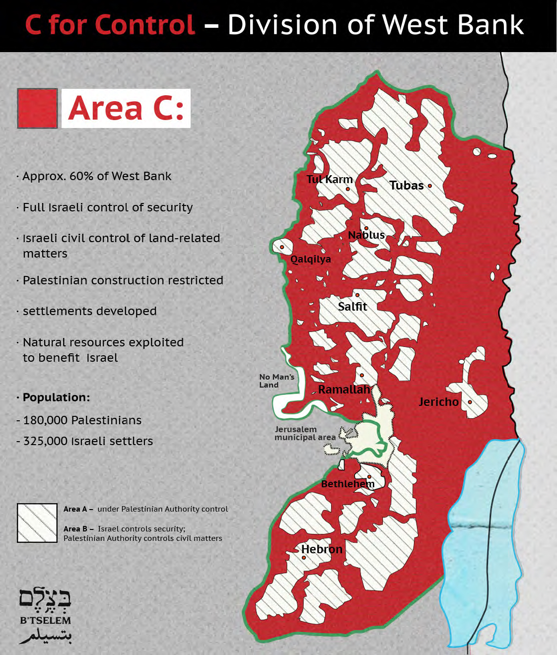
Above: The Oslo Accords set up three areas in the West Bank: A, B and C. This map shows how much of the West Bank is Area C (all the red aread) which is controlled by Israel. As settlements expand, so does that area. The striped white areas include Area B which is only particlaly under Palestinian control (Israel maintains security control, the Palestinian Authority has civil control) and Area A where the Palestinians are supposed to have full control. In reality, all Palestinians in the occupied territory, regardless of which areas they live in, find virtually all aspects of their lives deeply affected by the brutal occupation regime in the West Bank.
The largest area of red to the right/east on this map is the Jordan Valley, an fertile agricultural area being exploited by Israel. In its periodic reviews of the Palestinian economy, the World Bank has stressed that Palestinians must have access to the rich resources of the land in Area C, if they are ever to develop their economy.
All Map Pages:
• Maps “home page” includes map of The Middle East
• Ottoman Empire through 1949
• 1967 to the present
• Jerusalem
• Bethlehem (coming soon)
• Area C/ Jordan Valley (coming soon)
• Loss of Land